Elduvík - Funningsfjørður

  • elduvik-shawnogulu-jpg
    Elduvík village. Photo: @shawnogulu
  • 2019-08-23-elduv-k---funningsfj-r-ur-109-img-0136-jpg
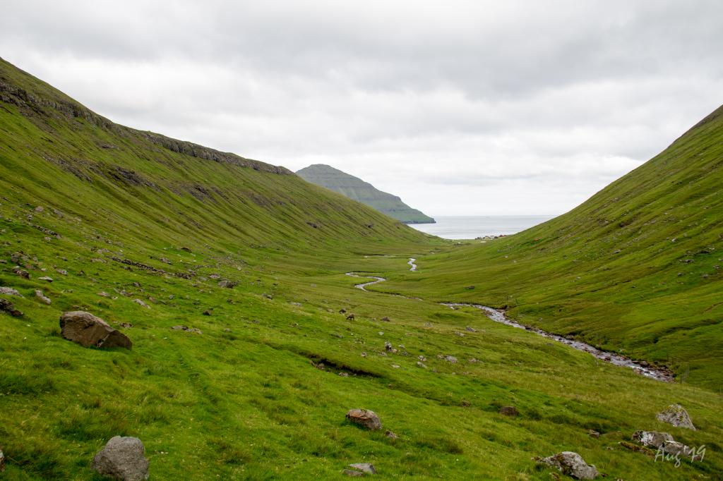
    The long and very scenic valley up from the village Elduvík. Here you walk all by yourself between the high and rugged mountains. The only thing you hear is the sound of the river. In the background the village of Elduvík. Photo: Óli Gardshodn.
  • 2019-08-23-elduv-k---funningsfj-r-ur-111-img-0146-jpg
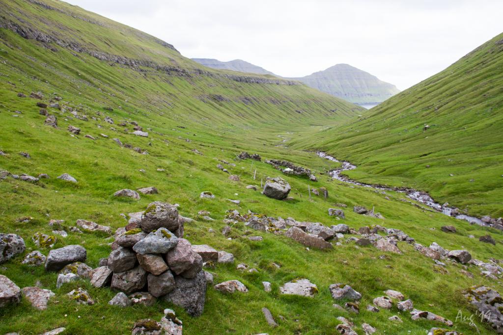
    The cairn and sheepfold under the gorge Øksnagjógv, in the valley of Elduvík. Photo: Óli Gardshodn
  • 2019-08-23-elduv-k---funningsfj-r-ur-121-img-0176-jpg
    Cairn at the small tarn called 'Tjørnin' at the pass above Funningsfjørður. In the background the mountain Múlatindur. Photo: Óli Gardshodn
  • 2019-08-23-elduv-k---funningsfj-r-ur-125-img-0191-jpg
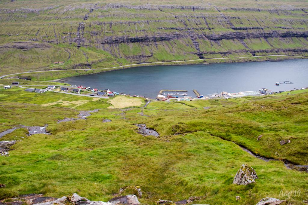
    View of the village of Funningsfjørður. Photo: Óli Gardshodn
  • funningsfj-r-ur-itsbigben-jpg
    The village of Funningsfjørður. Photo: @itsbigben
hike poster

An easy and pleasant walk through the beautiful valley in Elduvík

The village of Elduvík is by the sea, at the end of a long, green valley surrounded by high and steep mountains. 


The walk goes up through the deep valley, which seems pleasant and inviting, Stórá River flowing gently through it.  


The walk by the riverbank on the way to Funningsfjørður is lovely. 


It is good to walk the whole way from Elduvík to Funningsfjørður, although the drop is quite steep as you approach Funningsfjørður. 


The scenery in Funningsfjørður is stunning, the village being nestled between the two large fiords of the isle of Eysturoy. The village has been and still is a junction for traffic in the area, and the roads to the nearby villages are designated Buttercup Routes, scenic routes on particularly beautiful stretches of road.


The path can be taken in both directions.


The path is not visible everywhere and does not have cairns along some stretches. Therefore, a GPX file is necessary. 

Elduvík - Funningsfjørður
Funningsfjørður - Elduvík

Elduvík - Funningsfjørður

Public transport
As no public transportation is to Elduvík or Funningsfjørður, the villages are only accessible by car.

Arriving by car
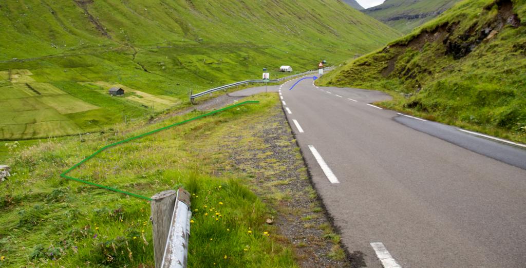
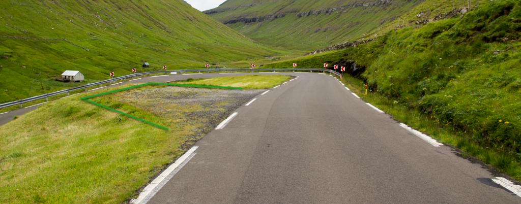
Parking, Elduvík
Good parking is found near the church in Elduvík. There are also parking places at the head of the path. (See photos)

  • gpx-kort-parking-and-startingpoint-jpg
    See green lines for parking and blue line for starting point
  • parkering---elduv-k-png
    See green lines for parking and blue line for starting point
  • parkering---elduv-k-2-png
    Green line indicates parking area

Funningsfjørður - Elduvík

Public transport
As no public transportation is to Elduvík or Funningsfjørður, the villages are only accessible by car.

Arriving by car
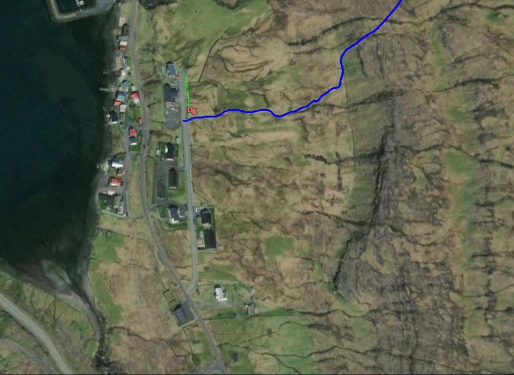
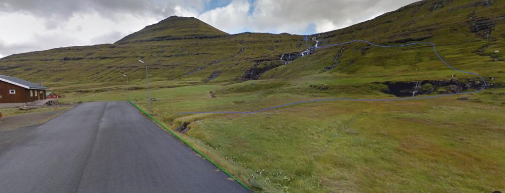
Parking, Funningsfjørður
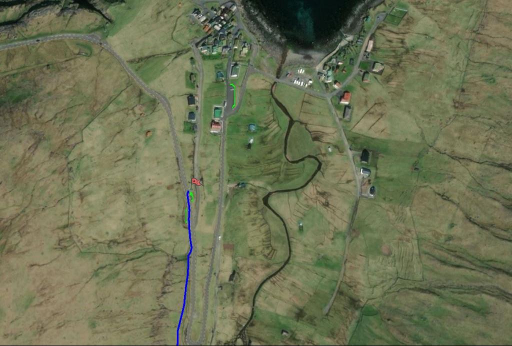
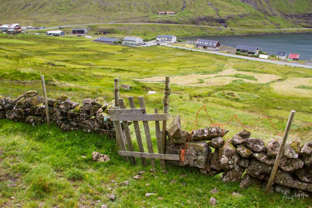
There are several parking spaces on the upper side of Ovari Vegur in the Á Flat neighbourhood. From there, walk along the creek up to a gate in the northern part of the rock fence above the road. The gate is visible from the road. (see photo)

  • gpx-kort-parking-and-startingpoint-funningsfj-r-ur---elduv-k-jpg
    Map: see green line for parking and blue line for starting point
  • parkering---funningsfj-r-ur-png
    See green line for parking and blue line for starting point
  • 2019-08-23-elduv-k---funningsfj-r-ur-131-img-0206-jpg
    Gate above Funningsfjørður
Elduvík - Funningsfjørður
Funningsfjørður - Elduvík

Elduvík - Funningsfjørður

Funningsfjørður - Elduvík

Facts

path icon
2h 30m

Duration

path icon
6 km

distance

hilltop peak icon
358 m

Peak

family icon
104 m

Elevation


family icon Suitable for children over 10 years
difficulty icon Medium - The entire path is easy to walk, although it is steep in places, especially above Funningsfjørður. A somewhat long hike with a high elevation gain
terrain icon Grass-covered and easy to walk. Steep at times, especially near Funningsfjørður. In places, quite wet terrain
6°C
9 m/s
Weather forecast

Available guided tours