Leynavatn - Vestmanna


Link Copied!

-
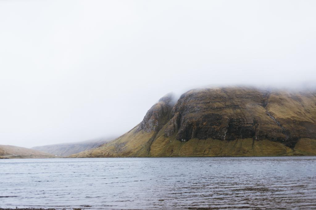 The hike starts by Leynavatn. Photo: Ingrid Hofstra
 -
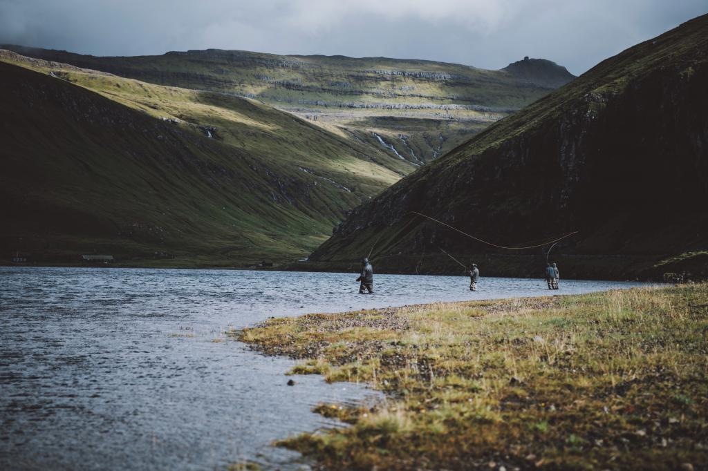 Fly fishing is popular on Leynavatn in the Faroe Islands. Photo: Jan Kellr
 -
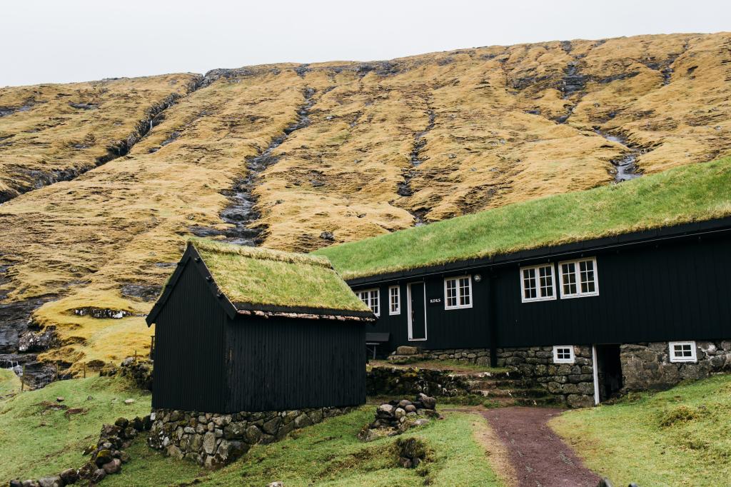 Michelin Star Restauran Koks is situated by Leynavatn. Photo by: Ingrid Hofstra
 -
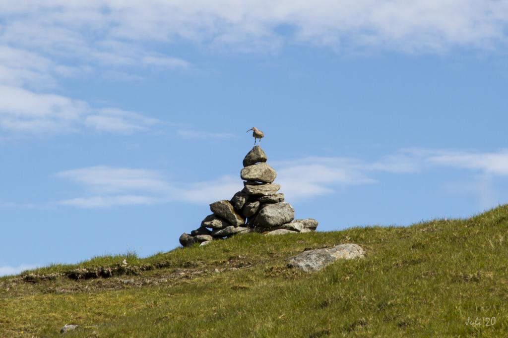 Cairn on the villagepath between Leynavatn and Vestmanna. Photo: Óli Garðshorn
 -
 Approaching Vestmanna you will cross a wide river and continue along the river down to a road leading into Vestmanna. Photo: Óli Garðshorn
The hike starts in the beautiful area by the gorge at Leynavatn, where the Michelin starred restaurant KOKS is located
Start by Leynavatn, where you can drive up the estuary Drangaósi and through the field of Oyrarnar as far as the car can go without crossing any deep rivers. The car can be parked on a sandy spit. From there walk into the valley along the river Dalá. Having come some way past Restaurant KOKS, located by the gorge, use the steppingstones to cross the river. Continue at an angle up to the sandy area call Navurtungan, where you cross the wide, beautiful river Ærgisá. With a lovely view of the valley, continue up along the river, cross the pass Goturshálsur and go down into the valley Heygadalur.
Having reached the first rise, you will see the first cairn of many, standing at close intervals, all the way down to the river in Heygadalur. Up high, the cairns are both large and close to one another, so it is easy to follow the path. However, the village path between Kvívík and Hvalvík cross your path at Goturshálsur. Therefore, take care that you follow the right cairns.
At Goturshálsur, you walk through Ognarhagin, the largest sheep pastures in the Faroes, with a base population of 500 ewes in winter. This is also the largest area of registered land in the Faroe Islands, about 15 km2.
Approaching Vestmanna, walk down to Heygadalur through the hill Tvørbrekkan. Here you will cross a wide river and continue along the river down to a road leading into Vestmanna. This river is one of the beautiful features of the valley.
It is easy to cross the big rivers in high summer. However, it can be far more difficult during other seasons, sometimes impossible.


Leynavatn - Vestmanna
Buses stop both in Leynar and in Vestmanna. See SSL routes 100/300
Both places are easiest to reach by car.
Arriving by car
Parking, Leynavatn
By Leynavatn you can drive quite far into the valley without having to cross any rivers (see the blue lines), where you can park on a sandy spit. From there, walk into the valley to reach path, which commences a little past where Restaurant KOKS is located.
-
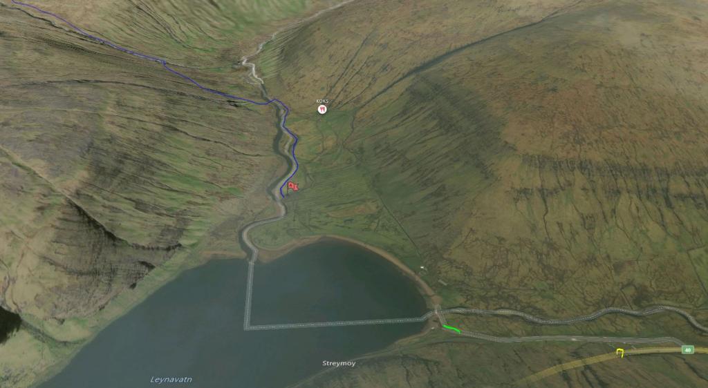 Follow the blue line for starting point. See green line for parking
 -
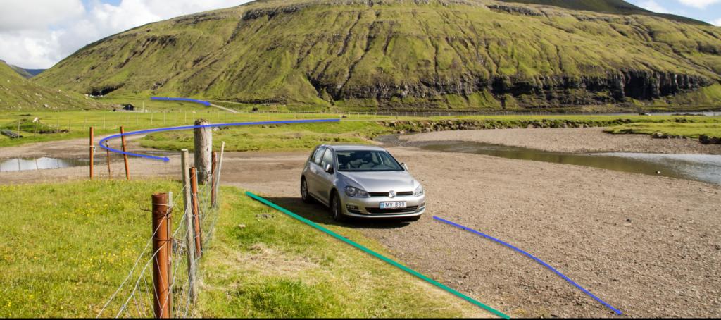 Parking Leynavatn. See green line for parking and blue line for starting point
Vestmanna - Leynar
Public transport
Buses stop both in Leynar and in Vestmanna. See SSL routes 100/300
Both places are easy to reach by car.
Arriving by car
Parking, Vestmanna
In Vestmanna, drive up the road Leitisvegur and park your car just above the dam in Heygadalur (see the green lines on the photo). From there, follow the blue line upward.
-
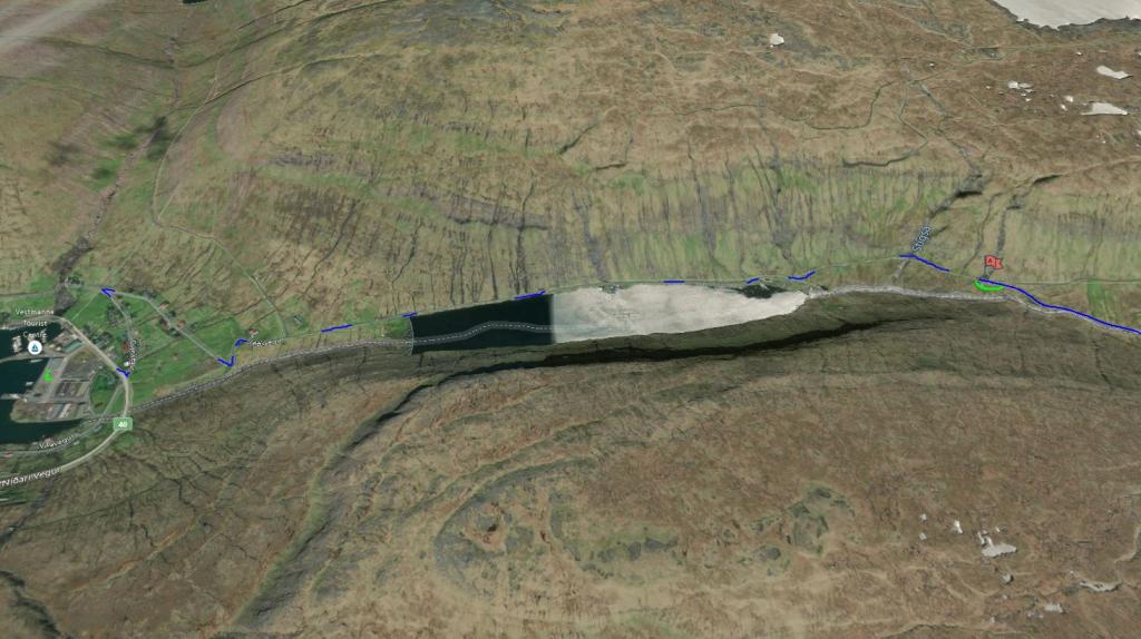 See green line for parking and blue line for starting point
 -
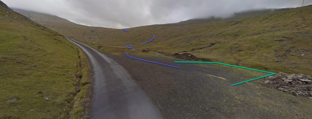 Parking in Vestmanna. See green line for parking and blue line for starting point
Leynavatn - Vestmanna
Vestmanna - Leynavatn
Facts

Duration

distance

Peak

Elevation
 Suitable for children over 10 years. If children are carried across the river, the hike is suitable for children 6-year-old and older. The path is good for walking, although quite long
 Difficult
- Two rivers must be forded. The water is at times high in the rivers, making them difficult to ford. No large steppingstones have been placed in this river, but there are enough rocks in it, which makes it crossable when it is dry in summertime.
If the water is high in Dalá, walk another 400 metres up the riverbank on its eastern bank until you reach the sheep shed at Ærgisáfløta, where you usually can cross the river close by the sheep pen
Difficult
- Two rivers must be forded. The water is at times high in the rivers, making them difficult to ford. No large steppingstones have been placed in this river, but there are enough rocks in it, which makes it crossable when it is dry in summertime.
If the water is high in Dalá, walk another 400 metres up the riverbank on its eastern bank until you reach the sheep shed at Ærgisáfløta, where you usually can cross the river close by the sheep pen
 Grass-covered and good for walking throughout. In places, it is quite wet, especially when crossing the pass Goturshálsur. Two rivers must be forded. When the waters are low, one can cross over steppingstones