


Oyrargjógv - Sørvágur


Link Copied!

-
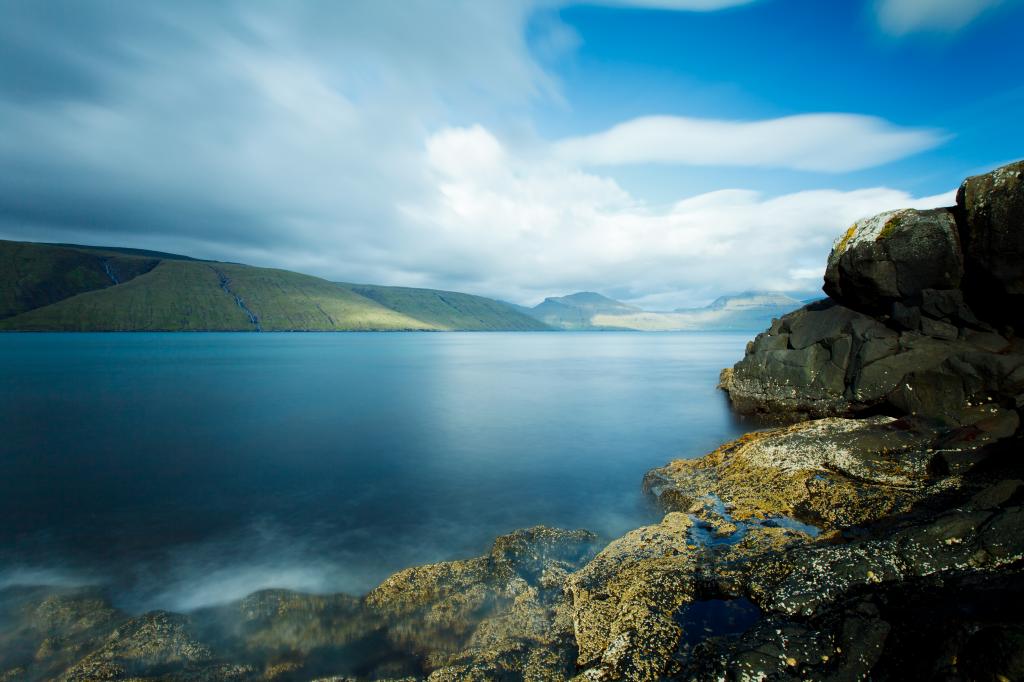 View over the stunning Vestmannasund with Streymoy Island in the background. Photo: Kimberley Coole
 -
 Rivers must be crossed on the hike from Oyrargjógv to Sørvágur, e.g. Kvígandalsá and Sjatlá, but these are easily forded. Photo: Óli Garðshorn
 -
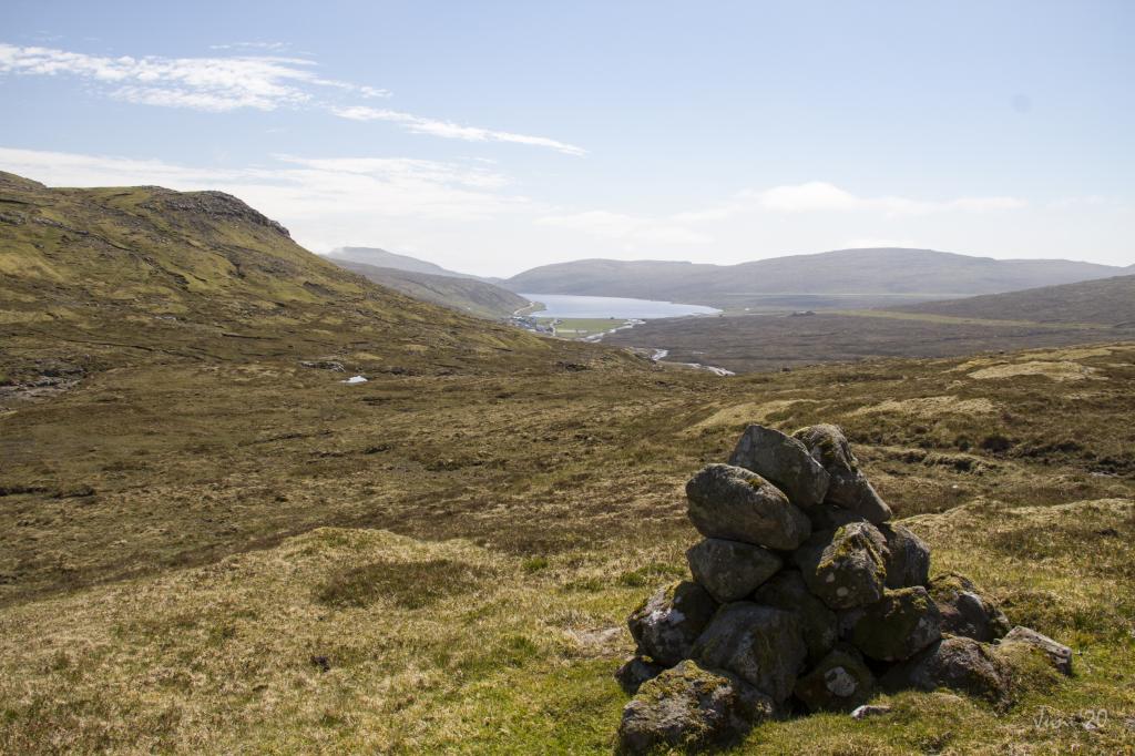 It is easy to follow the trail as cairns are set up the whole way. View over Leitisvatn and the airport from Kvígandalsá. Photo: Óli Garðshorn
 -
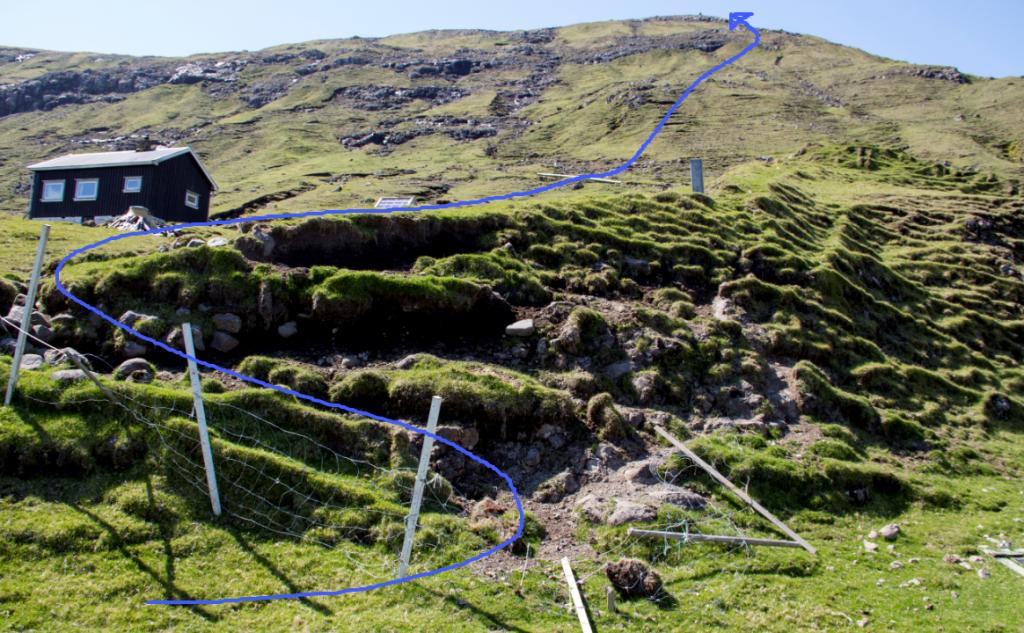
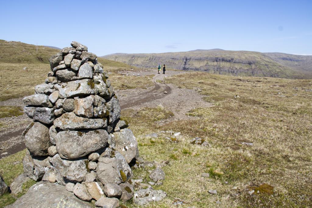 Apart from the strenuous stretch up from Oyrargjógv, the terrain is quite even, making for an easy hike. Photo: Óli Garðshorn
Ein lagaligur túrur gjøgnum vøkru og sløttu náttúruna í Vágum, har gingið verður eftir Sundsgøtuni gjøgnum Kvígandal, tvørtur um Kvígandalsá og Sjatlá vestur til Sørvágs, við góðum útsýni
Bygdagøtan byrjar á Oyrargjógv, har ein tekur seg beint niðan í líðina og haðan eftir Sundsgøtuni vestur til Sørvágs.
Varðar eru allan vegin, so gøtan er løtt at fylgja. Tá ið tungi teinurin niðan frá Oyrargjógv er undantikin, er rættiliga slætt og lætt at ganga túrin. Á vegnum ganga vit tvørtur um onkrar áir, t.d. Kvígandalsá og Sjatlá, men tær eru lættar at koma tvørtur um.
Søgnin sigur, at tað var eystan fyri Fjallavatn, at huldukonan í Húsagjógv tók at renna eftir seyðamanninum á Sondum, tí hann hevði tikið stakkin frá henni. Huldukonan rann aftan á honum til Vatnsoyrar og haðan niðan Vatnsbrekkuna og líka til Sandavágs. Huldukonan fekk seyðamannin aftur, men hann fekk tveitt seg inn um kirkjugarðin í Sandavági og fekk ermuna við sær. Erman sigst vera messuakul í kirkjuni.
Tað er møguligt at ganga túrin úr báðum endum.


Oyrargjógv - Sørvágur
Public Transport
There is no bus connection to Oyrargjógv, making a car necessary.
Arriving by car
Parking, Oyrargjógv
In Oyrargjógv you can park by the old ferry berth, which is close to the village path. From there, follow the blue line north to Oyrargjógv, where you go up the hill to the first cairn, which is visible from the shore.
-
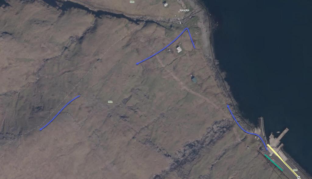 See green line for parking and blue line for starting point
 -
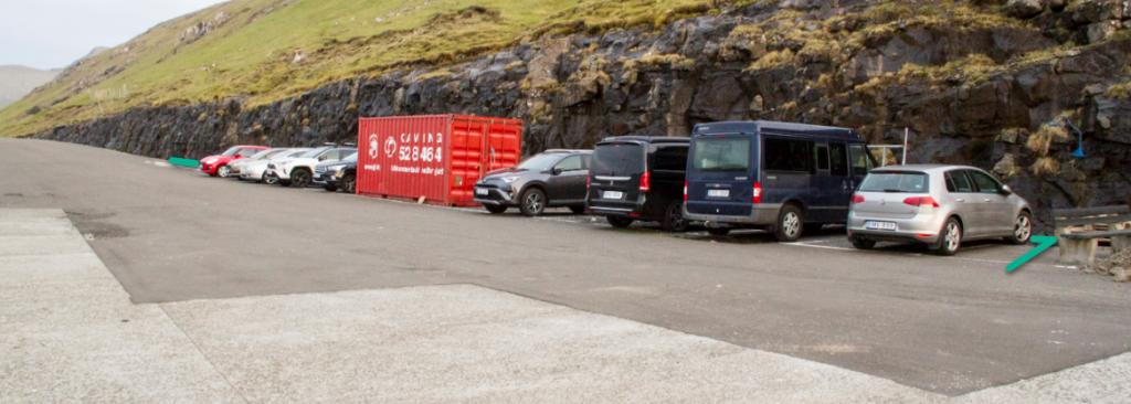 Parking in Oyrargjógv
 -
 Follow the blue line for starting point
 -
 Follow the blue line for starting point
Sørvágur - Oyrargjógv
Public Transport
Bus Route 300 goes to Sørvágur.
Arriving by car
Parking, Sørvágur: The best place to park in Sørvágur is by the water reservoir close to the unpaved road by the river Kirkjuá – note the green lines. From here, hike 600 metres along the blue line up to the gate in the infield, where the path begins. The first cairn is found just above the gate.
-
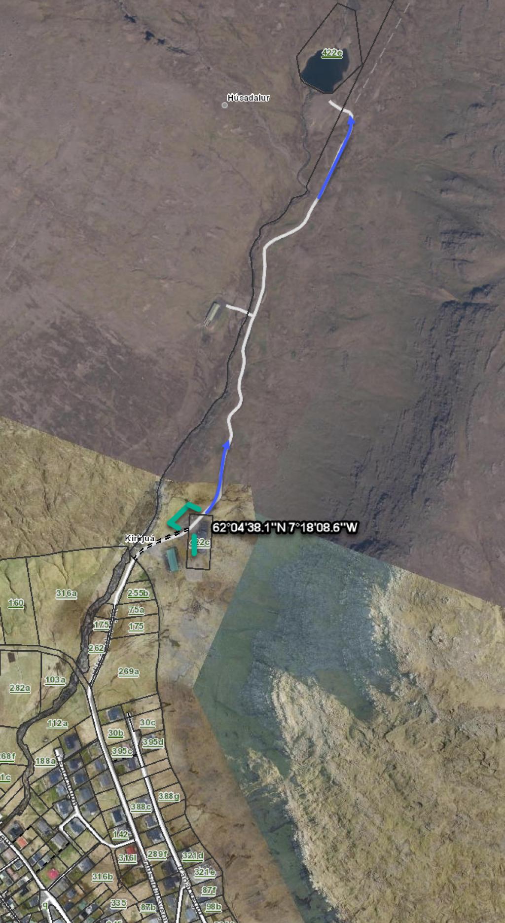 See green line for parking and blue line for starting point
 -
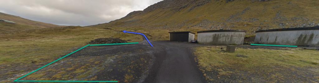 See green line for parking and blue line for starting point
Oyrargjógv - Sørvágur
Sørvágur - Oyrargjógv
Fakta

Tíð

longd

Hægsta stað

Hæddarmetrar
 Suitable with children over the age of 10.
A rather long hike for younger children and somewhat strenuous up from Oyrargjógv
Suitable with children over the age of 10.
A rather long hike for younger children and somewhat strenuous up from Oyrargjógv
 Medium
-
Medium
-
 Grass covered and easy to walk throughout
