


Saksun - Tjørnuvík


Link Copied!

-
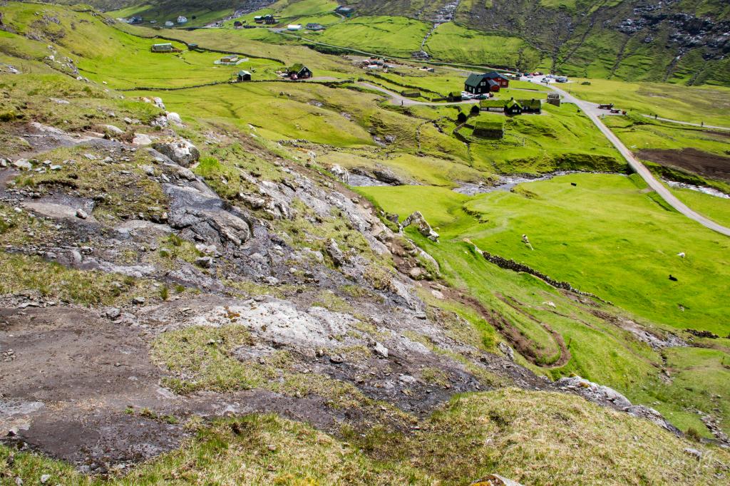 The path up from Saksun. To the right the ancient Dúvugarður in Saksun. Photo: Óli Gardshodn
 -
 The very beautiful iconic narrow canal into Pollin í Saksun. Photo: Óli Gardshodn
 -
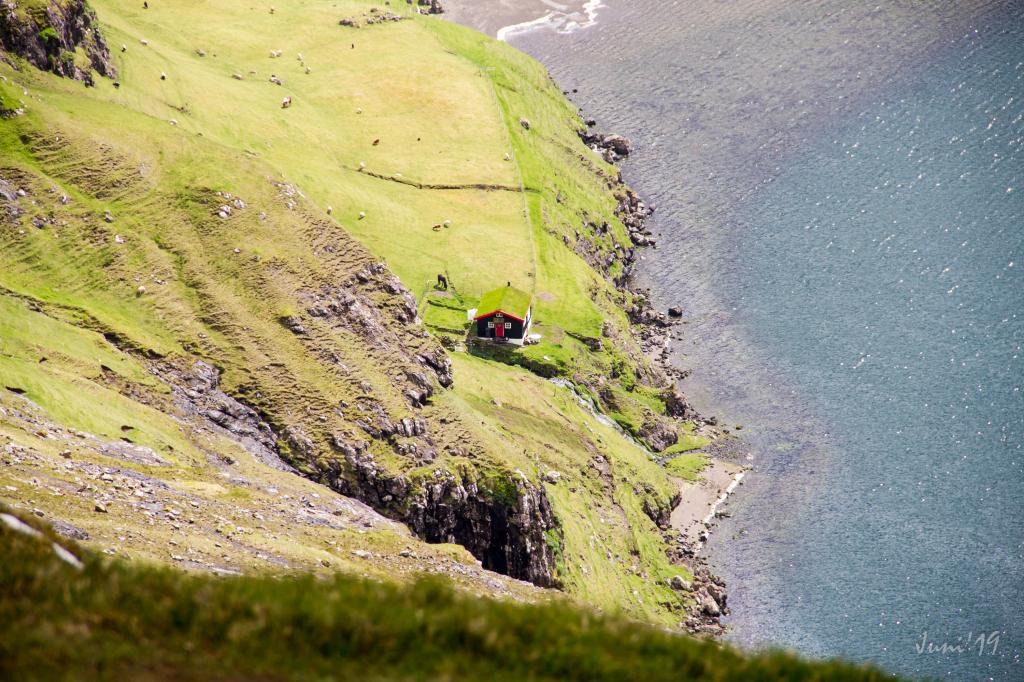 Cottage by the lake Pollin í Saksun. Óli Gardshodn
 -
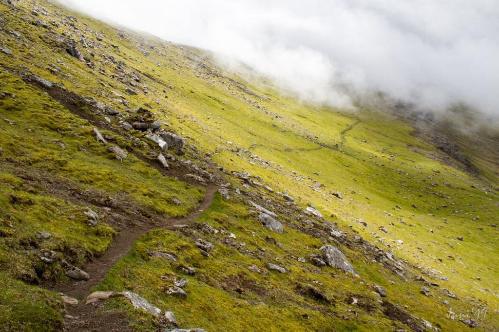 The path is visible most of the hike. Photo: Óli Gardshodn
 -
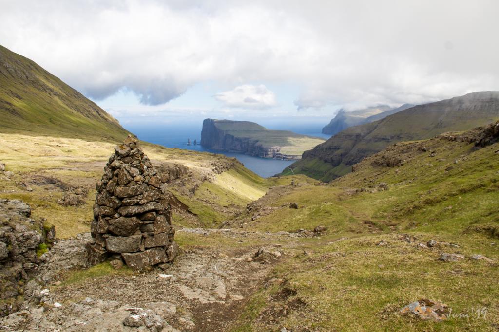 Cairn at Støðilsgil above Tjørnuvík. Photo: Óli Gardshodn
 -
 View above Tjørnuvík village. Photo: @dpc_photography
 -
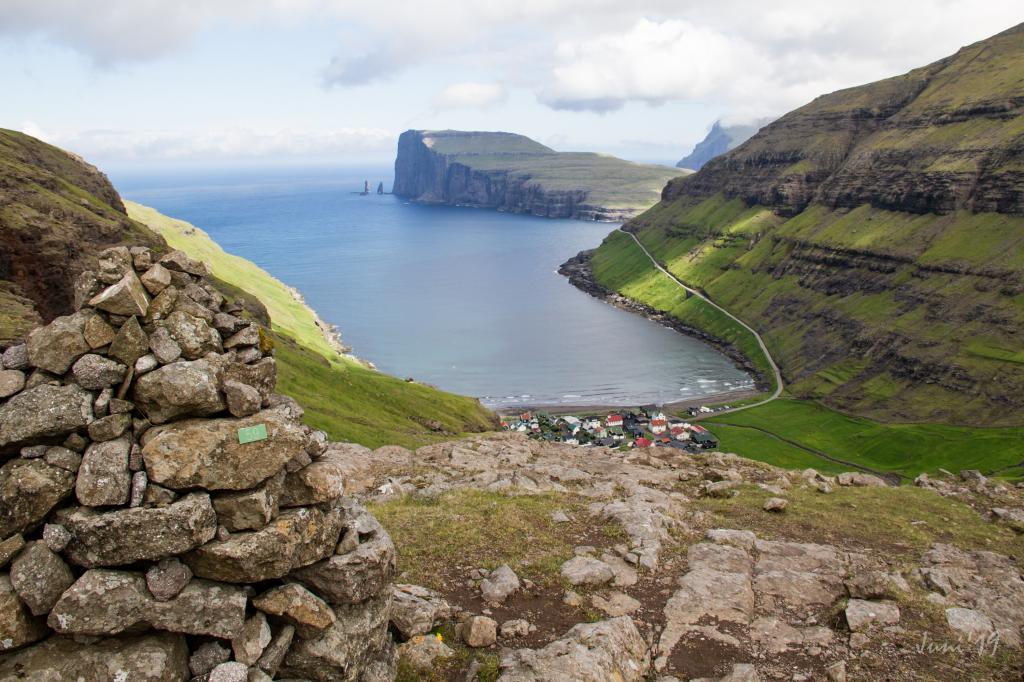 View above Tjørnuvík village. Cairn as signpost. Photo: Óli Gardshodn
Saksun er eitt av vakrastu og sermerktastu plássum í Føroyum. Túrurin til deiligu grannabygdina Tjørnuvík er ógloymandi
Leiðin byrjar við parkeringsplássið undir Dúvugørðum í ein landnyrðing úr stóru gjónni í Saksun. Dúvugarðar er fleiri hundrað ára gamal bóndagarður, sum nú er gjørdur til forminnissavn.
Gakk einar 50 metrar og snara til høgru, tá ið tú ert komin um brúnna um Skipá og gongur um 2-300 metrar niðaná gjøgnum bøin fram við ánni.
Tá ið tú ert komin út í hagan, far niðan tann fyrsta bakkan – um 30 loddrættar metrar, í somu hædd har ið fossurin fer útav. Hiðan skalt tú hyggja á skák niðan í ein landnyrðing. Á heygnum úti í sjónarringinum sært tú ein varða um ein kilometur burtur. Hav hann sum ýti. Teir fyrstu 200 metrarnar gongur tú í á leið somu hædd og kemur á gøtuna, ið gongur niðan á varðan.
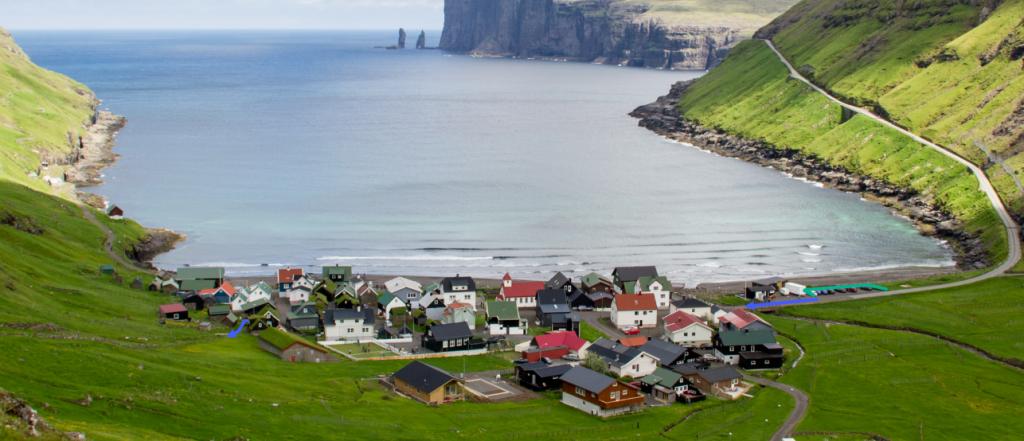
Høgu fjøllini rundan um Saksun geva bygdini ein duldan dám og ikki minni ein ófatiligan vakurleika. Pollurin var góð náttúruhavn, men eftir eitt ódnarveður í 1600-talinum fyltist havnin við sandi.
Á leiðini niðan á varðan er gøtan onkustaðni burtur, men tá ið tú ert komin niðan á varðan, er varðagøta allan teinin til Tjørnuvíkar. Varðarnir føra teg longur eysturá ímóti økinum Frammi í Dal, har ið Gellingará fer lykkjuskotin oman ígjøgnum dalin. Her er ein serlig kvirra, sum tryggjar tær sinnisrógv.
Nú kemur tú á Tjørnuvíksskarð, og gøtan heldur fram niðan brekkuna. Á Tjørnuvíksskarði er vakurt útsýni til Norðureysturoy. Haðan sært tú sermerktu drangarnar Risan og Kellingina. Søgan um tey bæði er, at tey vórðu send til Føroya at toga oyggjarnar til Íslands. Risin varð standandi í sjónum, men kellingin kleiv niðan á Eiðiskoll at binda oyggjarnar saman, so risin kundi fara við teimum. Síðan setti hon so harðliga av, at Kollurin støkk sundur. fyrireikanin var drúgvari enn væntað, og tá ið tey vóru búgvin at fara til Íslands, reis sólin úr kavi, og tey vórðu til stein.
Hiðan sært tú eisini Slættaratind og Gráfelli, sum – við sínum 880 og 856 metrum – eru hægstu fjøll í Føroyum.
Fylg varðunum allan vegin oman til Tjørnuvíkar. Henda tættbygda bygdin er ógviliga vakur og sjarmerandi partur av Føroyum. Tjørnuvík er kend fyri sín serliga sálmasong, Kingo-sangin, sum er elligomul sálmasiðvenja, sum stavar frá danska sálmaskaldinum Thomas Kingo. Bygdin hevur eitt kór, ið syngur Kingo sálmar. Tjørnuvík hevur eisini ein góðan sand og lógv, sum brýtur, og tað dregur nógv vitjandi.
Túrurin er vakur at ganga báðar vegir.


Saksun - Tjørnuvík
Public transport
Saksun is not reachable by public transport. Route 202 from Oyrarbakki is driving to and from Tjørnuvík.
Arriving by car
Parkering, Saksun
The public parking lot near the church in Saksun is a good place to park your car. From here, walk over the bridge, where you will find the starting point of the path (illustrated with a blue line on the picture).
-
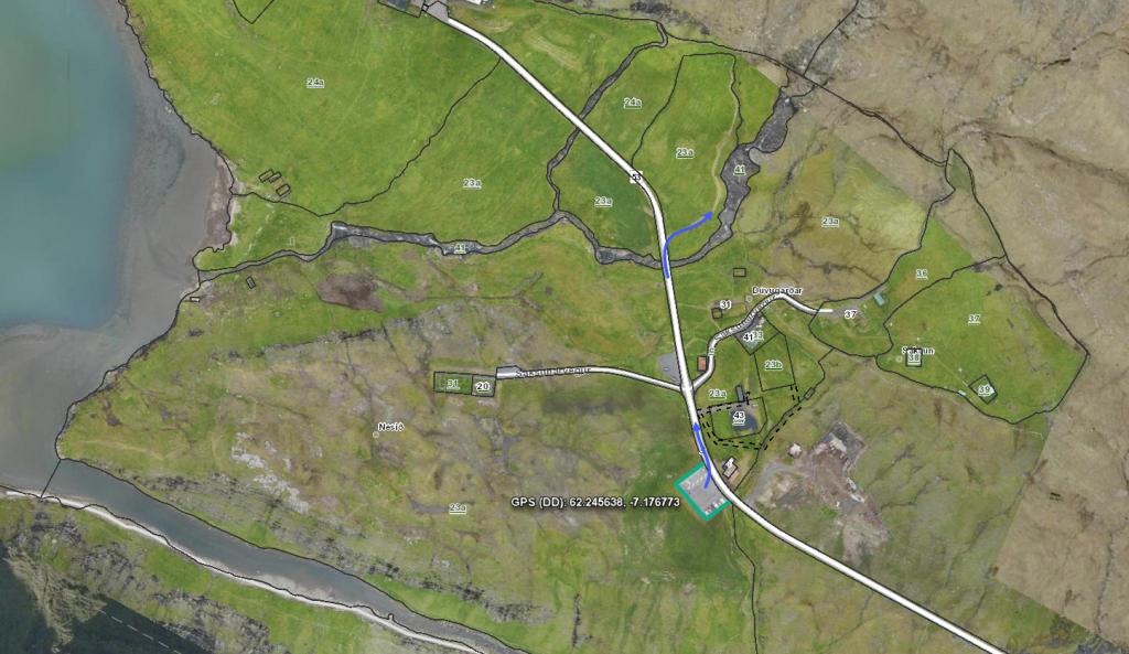 See green line for parking and blue line for startingpoint
 -
 The beginning of the village path in Saksun goes up on the first crag and the to the left. Photo: Óli Gardshodn
 -
 The village gate in Saksun. Photo: Óli Gardshodn
Tjørnuvík - Saksun
Public transport
Saksun is not reachable by public transport. Route 202 from Oyrarbakki is driving to and from Tjørnuvík.
Arriving by car
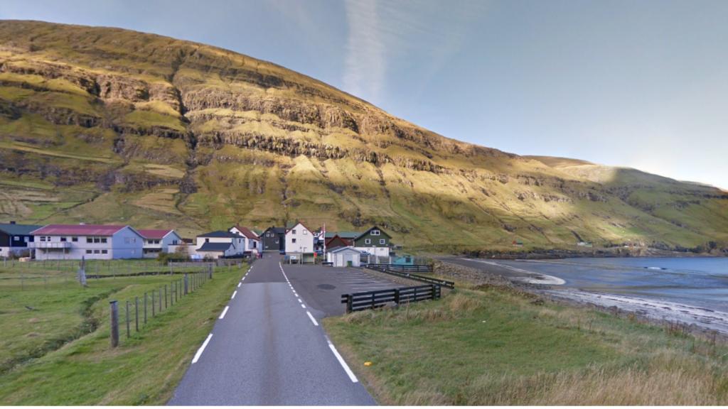
Parkering, Tjørnuvík
The public parking lot situated by the main road when you enter the village. From there, you walk across the bridge, along the church and through the village to the point where the path begins (illustrated with a blue line on the picture).
-
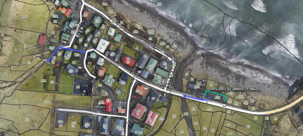 See green line for parking and blue line for startingpoint
 -
 parking in Tjørnuvík
 -
 See green line for parking and blue line for startingpoint
Saksun - Tjørnuvík
Tjørnuvík - Saksun
Fakta

Tíð

longd

Hægsta stað

Hæddarmetrar
 The route is suitable for children above 8 years
 Medium
- Somewhat difficult from Saksun and up to the first cairn
Medium
- Somewhat difficult from Saksun and up to the first cairn
 Grass path. In some places stones and rocks the first leg. Then cairn path, mostly with grass surface
