
You haven’t got any favourites yet
This is where you can collect inspiration, articles, events and places that interest you.
Click the icon on pages and they’ll appear here.
Your favourites
Events & Tours
Places
Hiking
Sandavágur – Slættanes – Gásadalur


-
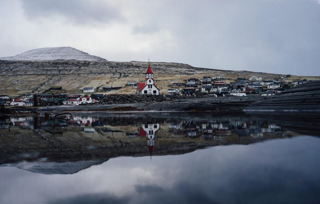 Sandavágur Photo: Erik-Hageman
 -
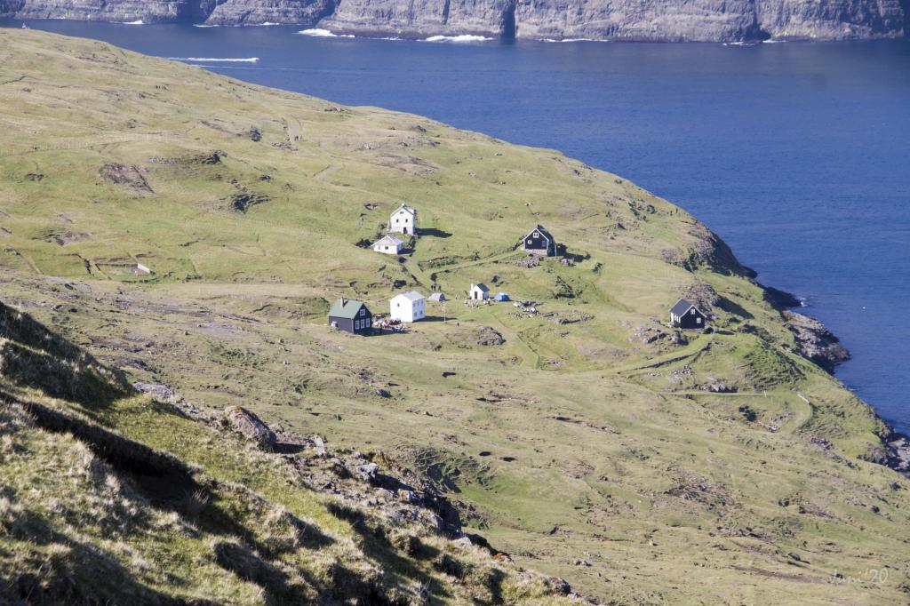 Suddenly the village of Slættanes arrives. Once left but now a tempting place for a remote summerstay. Photo: Óli Gardshodn
 -
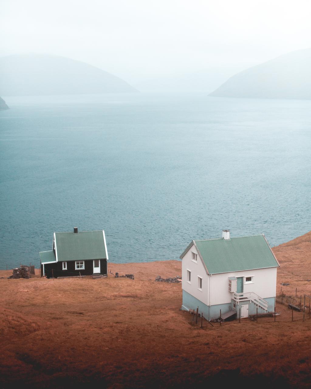 Slættanes Photo: Rannvá Joensen
 -
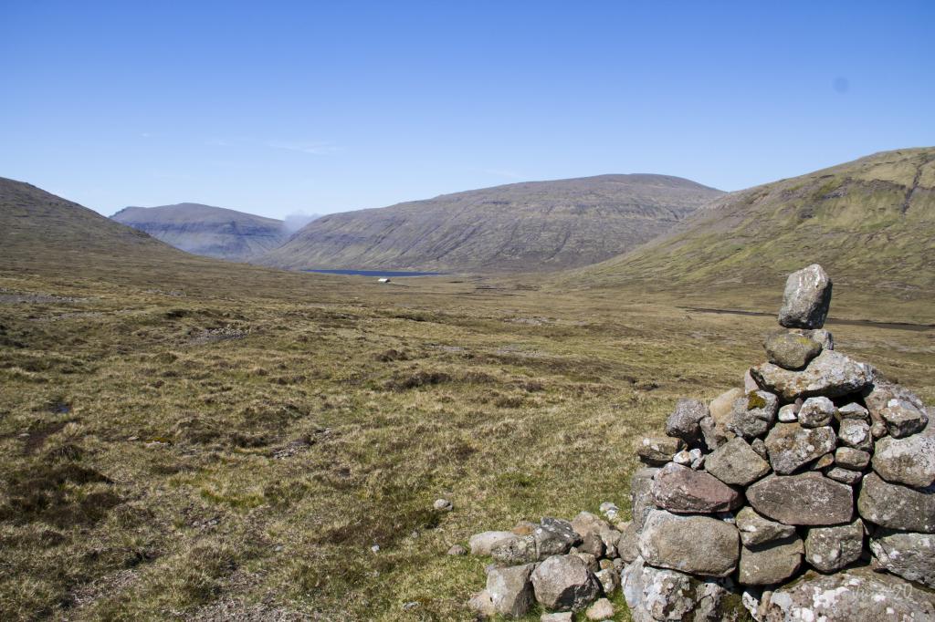 View from the Slattanes path north over the lake of Fjallavatn. Photo: Óli Gardshodn
 -
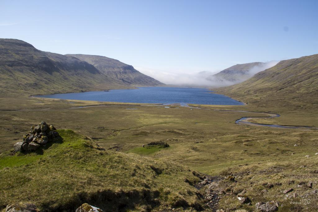 View from a cairn over Fjallavatn. Photo: Óli Gardshodn
 -
 Fjallavatn Photo: Chris Eyre-Walker
 -
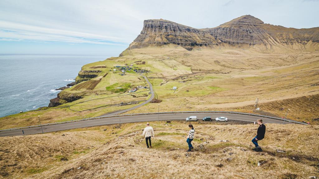 villagepath above Gásadalur. Photo: @gilli.photography
 -
 Gásadalur Photo: Fabio Zingg
Enjoy this adventurous route to some of the most beautiful pearls in the Faroe Islands
SANDAVÁGUR (Á HÁLSI) - SLÆTTANES
The route starts at the parking lot á Hálsi before Sandavágur (also called Sandavágshálsur). Go diagonally to the left toward the gorge called Ravnagjógv and follow the path uphill. Here, you will find the first cairn on the cairn path. This is the old path that connected the villages of Sandavágur and Slættanes. All traffic between the settlements took place on this path.
After one to two kilometers, the terrain evens out, and you have a good view over a large part of Streymoy, the villages of Skælingur, Leynar and Kvívík, and the southern mountains of Skælingur and Sátan. Soon, the charming village of Vestmanna appears on the other side of the fjord. For many years, Vestmanna was a hub for traffic to Vágar and the airport. A ferry sailed between Vestmanna and Oyrargjógv, but was replaced by a subsea tunnel in 2002, the first of its kind in the Faroe Islands.
After about five kilometres, another cairn path crosses the path. This is the path between Sørvágur
and Oyrargjógv. Stay on your current route. It can be difficult to see the path and the next cairn in some places, but if you take your time, you will find them. By Fótamørsklettur, you will find a rather square stone next to the fence. This type of stone is called Hav. In ancient times, men used to compete by lifting the stone and seeing who was strongest. Be careful not to hurt your back if tempted to match your strength with the strong men of the Faroe Islands.
When you pass Tungufellið Lítla, the path separates into two. You must follow the lower of the cairns. The other is a horse path that leads into the mountains. Follow the cairns down through Skáardalur and soon you arrive in Slættanes.
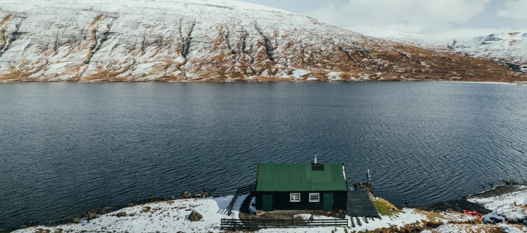
There are a few houses in Slættanes, but they are usually empty because the village is uninhabited. The settlement has only been inhabited for a period of around one hundred years. A family moved to Slættanes in 1835 and spent the first five years alone in this desolate place. Others then arrived, and in 1940, 75 people lived in Slættanes. Sometimes there were even more people. In 1964, the last inhabitants of the village left.
SLÆTTANES - FJALLAVATN
From Slættanes you move up to Skoradalshálsur. You will find the path by the end of the road above the village. Follow the cairns uphill towards Skoradalshálsur.
On Skoradalshálsur you have a stunning view to the north of Streymoy, including the famous Vestmanna bird cliffs and Snubburnar, which - with its very sharp and steep shape - is one of the most beautiful mountains in the Faroe Islands. Here, you are at the threshold of some of the most beautiful places that Vágar has to offer.
Follow the path down to Reipsá, which is the river from the north end of Fjallavatn. The lake is the second largest lake in the Faroe Islands. The largest, Leitisvatn (also called Sørvágsvatn and Vatnið), is also on the island of Vágar.
From Skoradalshálsur you can choose a more offroad route down to Reipsá. You can walk towards the mountains in the north (on your right), follow the ridge westwards and then get back on the path again by Reipsá. The view is unique over the green hills and blue sea. However, be careful, as the terrain is very steep and there are some gorges, and the area downhill towards Reipsá is quite rocky and uneven.
FJALLAVATN - GÁSADALUR
It can be difficult to cross Reipsá without getting your feet wet but try to find a place where the river runs slower. You cross Gullringsá, which is the stream that runs down the mountainside on the left.
Before going up, you must remember to glance towards Víkar, which is another uninhabited village. It was founded in 1833 but was abandoned in 1932. The settlement is indeed very remote, since the distance to the nearest village is about two hours on foot and in difficult terrain. The area is incredibly beautiful with the small beach in the hook, the green carpet of grass and steep Árnafjall towering over the area.
Follow the path diagonally uphill towards the mountain wall. It can be a little confusing here because it can look like there are several paths. But when you get further uphill and westwards, you will see the path that goes through Kálvarók more clearly. Beware of slippery rocks in some places on the way up. Follow the cairns through Jøkladalur and Kjógvadalur. Then you come up to Gresskarðadalur. Here, the path is difficult to see. Walk upwards by Bustin and further towards Bustardalur.
From Bustin, located at approximately 595 meter altitude, and further to Bustardal you have clear view of Árnafjall, which is the highest mountain in Vagar. Right behind you is Eysturtindur - second highest mountain in the island. Here, it's perfect to take a coffee break and enjoy the veiw of the light from the evening sun shadowing the mountains near you.


Sandavágur – Slættanes – Gásadalur
Public Transport
Route 300 between Tórshavn and the Airport stops in Sandavágur.
Route 350 stops in Sandavágur, Gásadalur and Tórshavn.
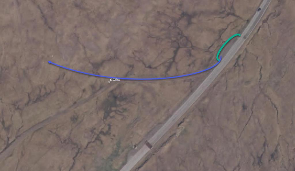
Parkering, Sandavágur
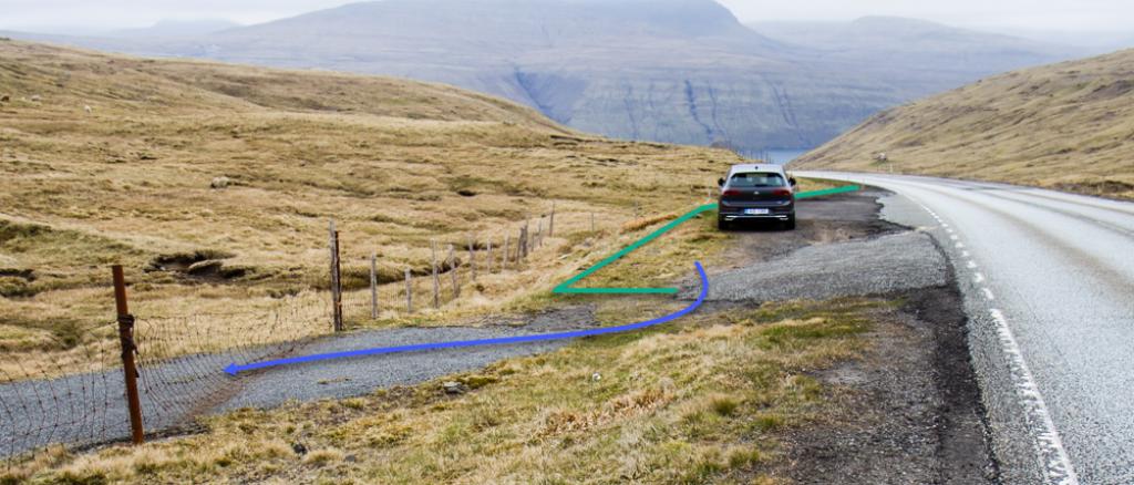
Good parking conditions are close to the starting point Á Hálsi (Sandavágshálsur) 100m east of the cattle grid is a parking lot. Park here and walk through the gate.
See the green lines.
The route is not visible here but walk 100 m on the road until you reach the first turn. Now hike to the right from the road and towards the large gorge Ravnagjógv and the mountain Lírisfelli. West of Lírisfelli you will reach the village path. Look for the cairns on your left.
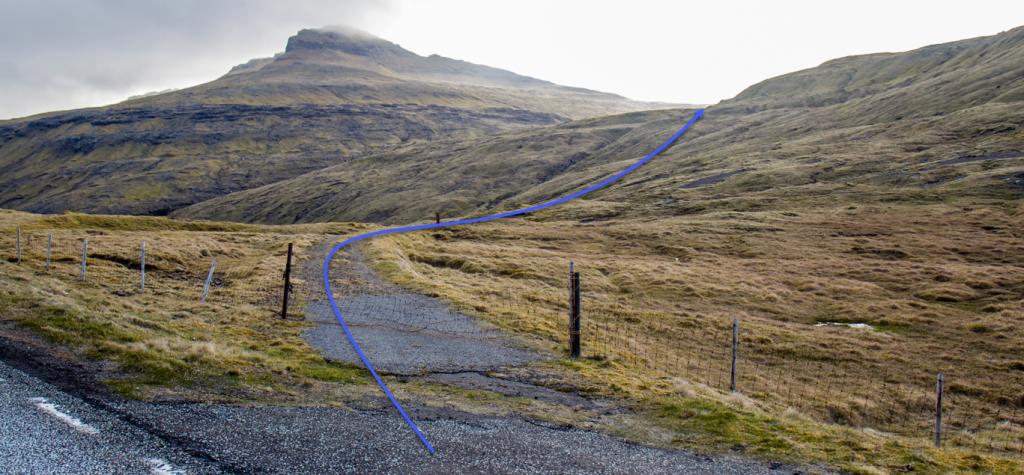
See blue lines for description.
-
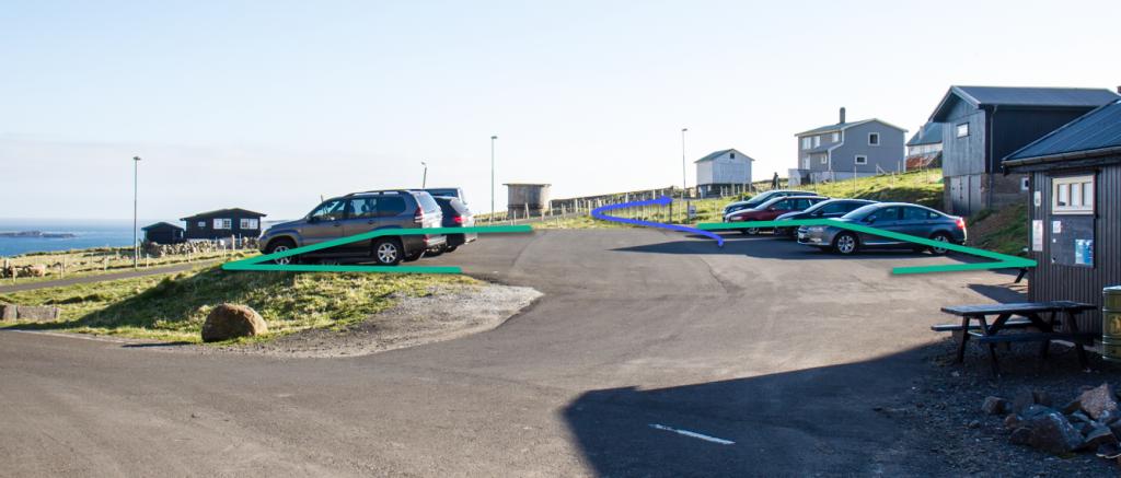
 See green line for parking and blue line for starting point
 -
 See green line for parking and blue line for starting point
 -
 See green line for parking and blue line for starting point
Gásadalur – Slættanes – Sandavágur
Public Transport
Gásadalur is reachable by public transport by driving from Tórshavn on bus rute 350.
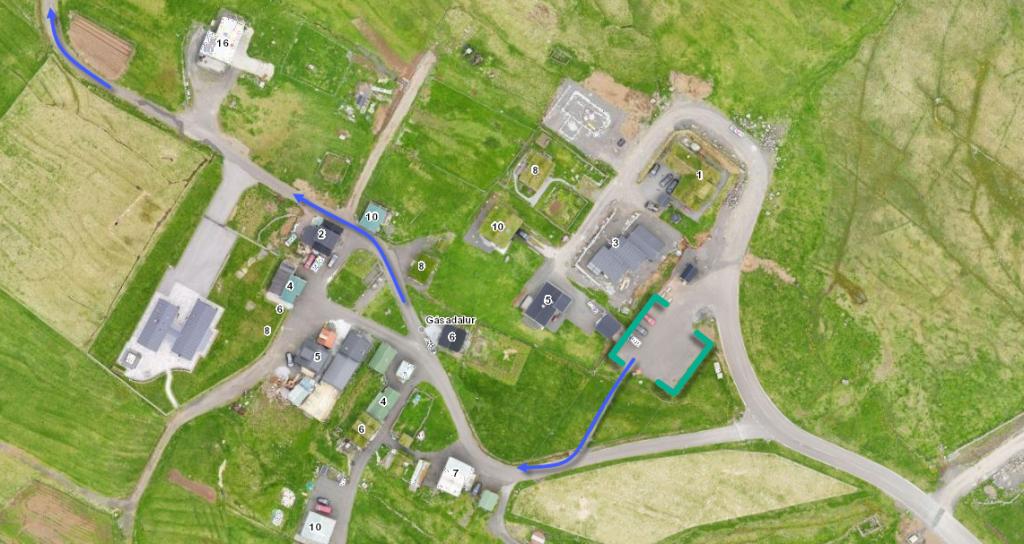
Parking, Gásadalur
The best parking options for this hike is on the parking lot in the village of Gásadalur – right by the public restrooms.
Then follow the blue line towards the sheepfold. From the sheepfold you can see the first cairn.
-
 See green line for parking and blue line for starting point
 -
-
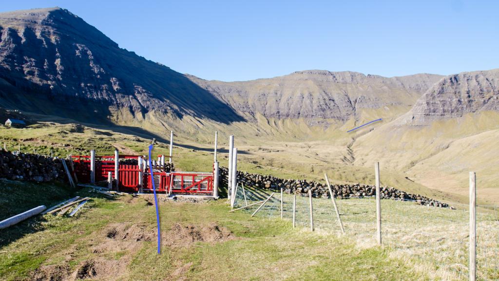 See blue line for starting point
Sandavágur – Slættanes – Gásadalur
Gásadalur – Slættanes – Sandavágur
Facts

Duration

distance

Peak

Elevation
 Because the trip is long, it is not suitable for small children. Children from 10-12 years of age can participate, but you could consider dividing the route in two to three stages
 Expert
- 25 km and 1400 meters of elevation is difficult if not in a good hiking shape. The hike can be shortened by dividing it, so you pass down to Fjallavatn and then Vatnsoyrar. If you choose this option, you should get a permission from a landowner beforehand.
Expert
- 25 km and 1400 meters of elevation is difficult if not in a good hiking shape. The hike can be shortened by dividing it, so you pass down to Fjallavatn and then Vatnsoyrar. If you choose this option, you should get a permission from a landowner beforehand.
 Grass path with cairns. The first part of the route to Slættanes is on flat ground and then goes downhill. In some places, rocks and stones. It is best to do this hike in dry weather as is can be wet across Mýrarnar by Fjallavatn and you will have to wase across the river at Fjallavatn