Signabøur – Kaldbak

  • Hiking-Villagepath-Faroe-Islands-Signabøur-Kaldbak
    Hiking up the hill from Signabøur. Photo: Kirstin Vang
  • Hiking-Villagepath-Faroe-Islands-Signabøur-Kaldbak
    It is safer to walk from Signabøur to Kaldbak than going the other direction, as it is easier to see how to walk up through the crags and ledges. Photo: Kirstin Vang
  • Hiking-Villagepath-Faroe-Islands-Signabøur-Kaldbak
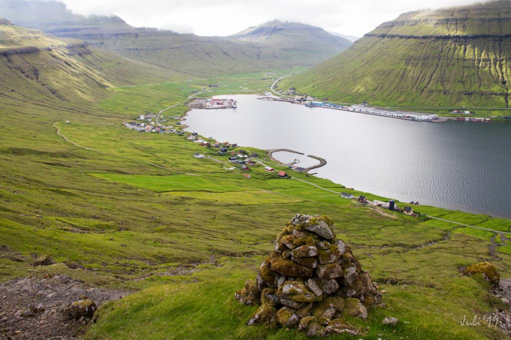
    When hiking up the hill from Signabøur, you are rewarded with an impressive view over Kollafjørður and into the valley Kollfjarðadalur. Photo: Óli Gardshodn
  • Hiking-Villagepath-Faroe-Islands-Signabøur-Kaldbak
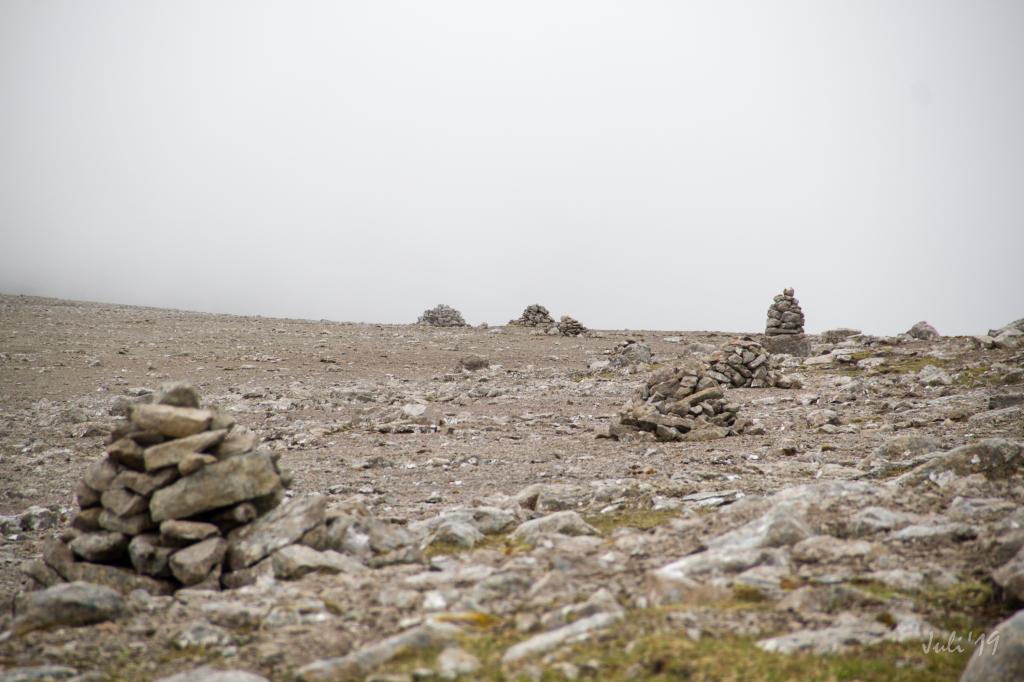
    Reaching the pass Kambsskarð, everything turns quiet on the nice walk through the pass with its many beautiful cairns. Photo: Óli Gardshodn
  • Hiking-Villagepath-Faroe-Islands-Signabøur-Kaldbak
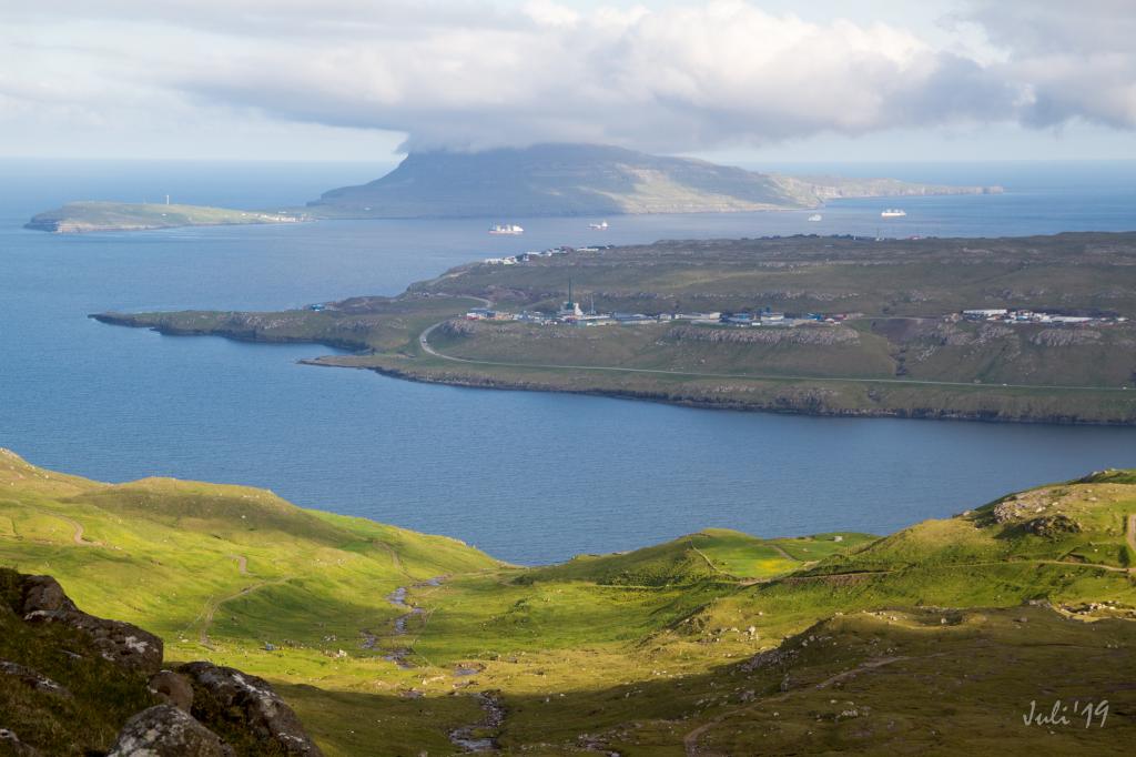
    The view on the way down to Kaldbak. Photo: Óli Gardshodn
hike poster

Let the alluring cairns guide you on this challenging hike. Above Kaldbak you can enjoy the picturesque view of valley with many small lakes and pools

When hiking up the hill from Signabøur, you are rewarded with an impressive view over Kollafjørður and into the valley Kollfjarðadalur.


Reaching the pass Kambsskarð, everything turns quiet on the nice walk through the pass with its many beautiful cairns. Having crossed the pass, you can enjoy a view down into the big and lovely valley above Kaldbak with its many small lakes and pools, including Stóravatn and Brúnavatn. The stretch through the valley is relatively long but several gullies make it a fascinating walk. The rivers are easily forded.


It is safer to walk from Signabøur to Kaldbak than going the other direction, as it is easier to see how to walk up through the crags and ledges. There is also more traffic noise in Signabøur, making the quiet area near Kaldbak more enjoyable to walk in.


From Signabøur walk on the road past the barn and then go uphill in a westerly direction, climbing over one fence and through a gate before going at an angle southward toward the first cairn below the path that leads up through the first crag.

Signabøur – Kaldbak
Kaldbak – Signabøur

Signabøur – Kaldbak

Public transport
You can take the red city busses from Tórshavn to both Signabøur and Kaldbak.

Arriving by car
Parking Signabøur
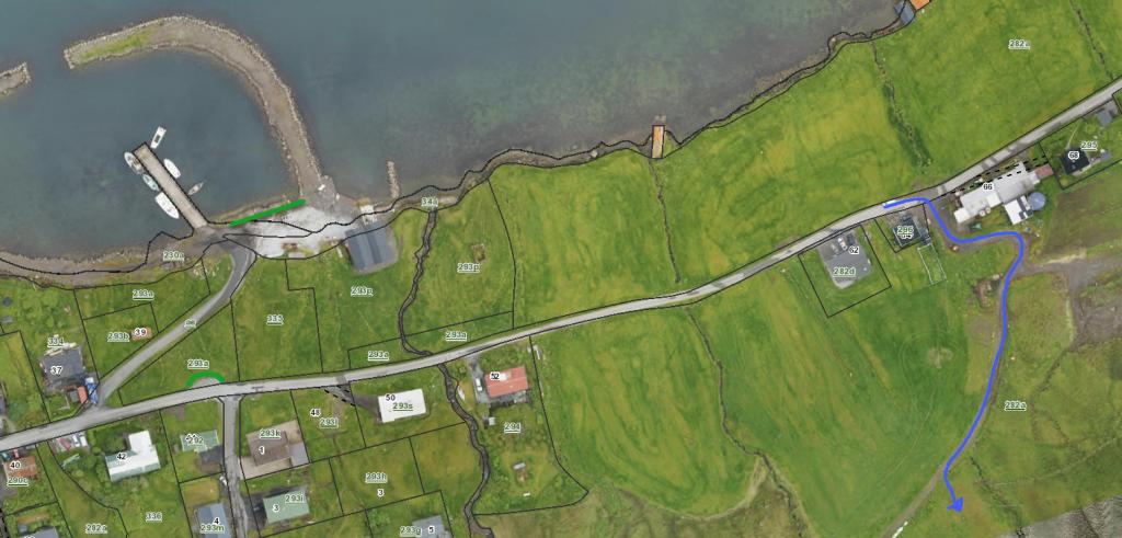
Parking is not good in Signabøur. The closest lay-by is 250 metres west of where the path begins. You can also park your car down by the marina, 300 metres from where the path starts. (see the photos)


  • Parking-Startingpoint-Signabøur
    See green line for parking and blue line for starting point.

Kaldbak – Signabøur

Public transport
You can take the red city busses from Tórshavn to both Signabøur and Kaldbak

Arriving by car
Parking, Kaldbak
Good parking is found in Kaldbak. A big parking lot is by the bus shelter, 60 metres from where the path begins. You can also park by the road leading down to the marina. (see the photo

  • Parking-Startingpoint-Kaldbak
    See green line for parking and blue line for starting point.
Signabøur – Kaldbak
Kaldbak – Signabøur

Signabøur – Kaldbak

Kaldbak – Signabøur

Facts

path icon
2h 30m

Duration

path icon
8 km

distance

hilltop peak icon
557 m

Peak

family icon
556 m

Elevation


family icon The hike is suitable with children over 10 years
difficulty icon Difficult - It can be challenging to hike up the steep hill from Signabøur up through the crags. The ground can be loose at different places. Since it is precipitous at times, the hike is not suitable for people who suffer from fear of heights
terrain icon The hike up through the cairn paths in Signabøur is steep. The path is good to walk, but at times you hike over bedrock and ground with loose rocks, on which you may lose your footing if you are not careful. When you have ascended further up, the trail becomes easier to walk. Having reached the pass, the path across it and all the way to Kaldbak is easy to walk
6°C
9 m/s
Weather forecast

Available guided tours