


Sørvágur - Slættanes


Link Copied!

-
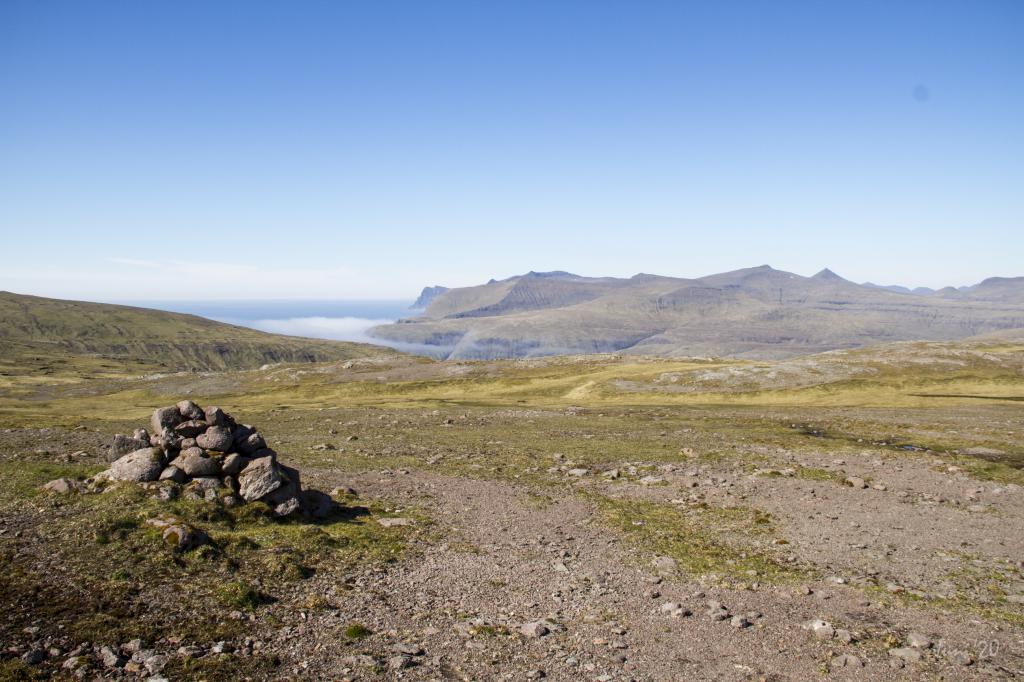
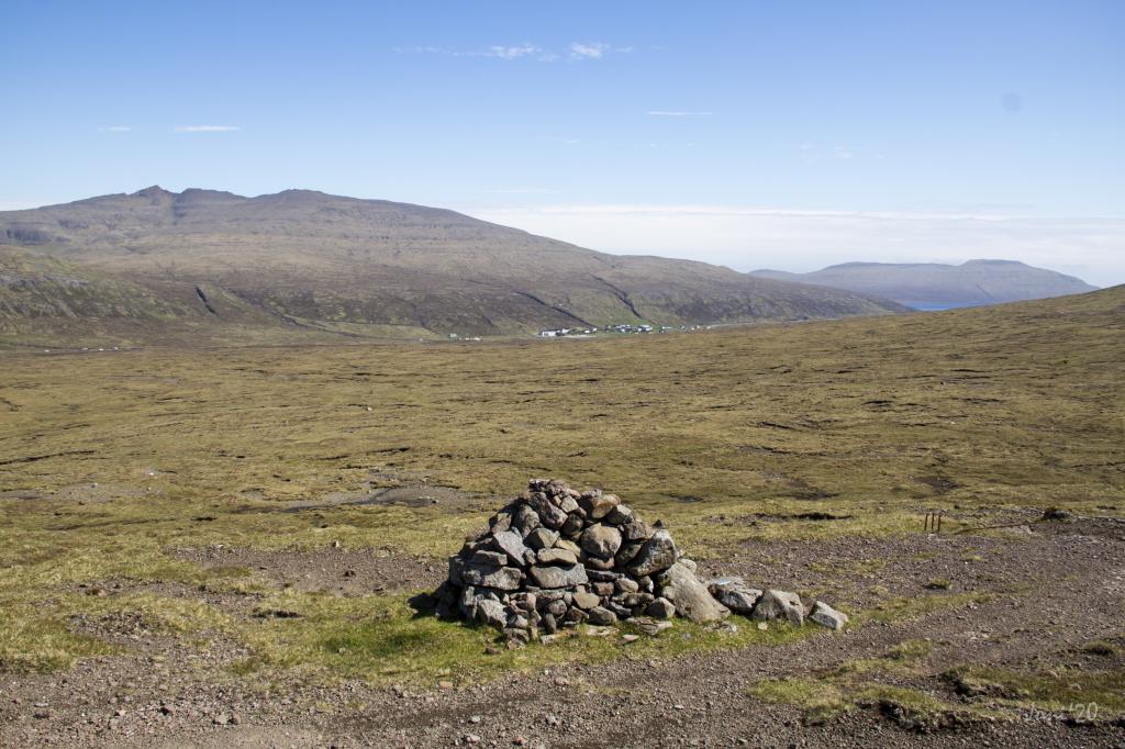 View and cairn as signpost above Sørvágur. Photo: Óli Gardshodn
 -
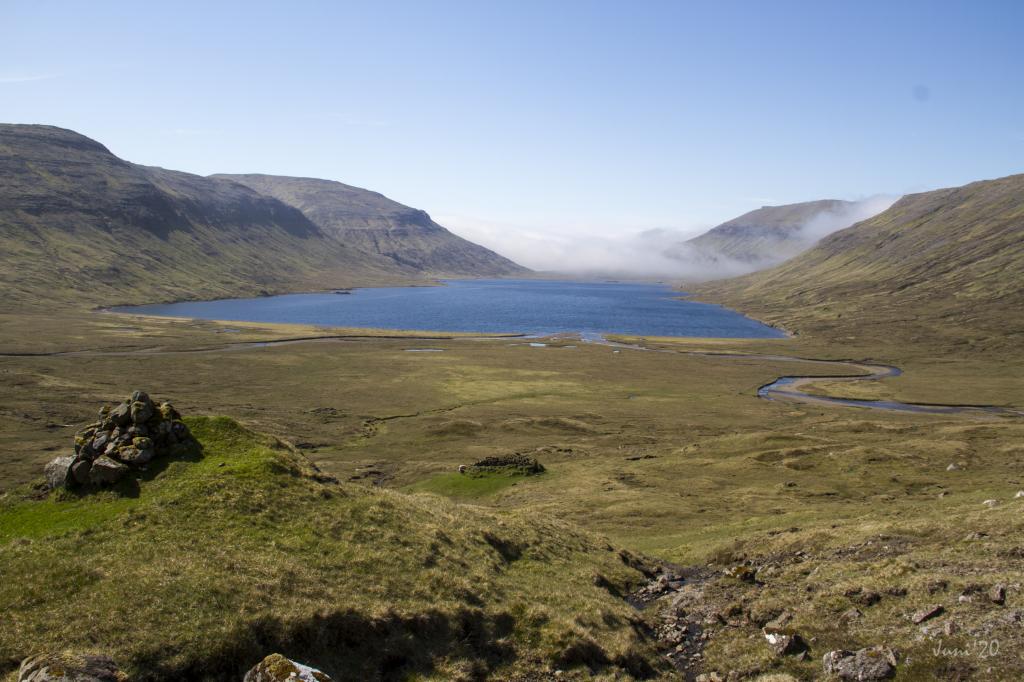
 View from the Slattanes path north over the lake of Fjallavatn. Photo: Óli Gardshodn
 -
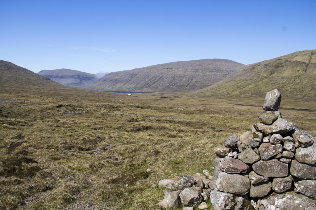
 View from a cairn over Fjallavatn. Photo: Óli Gardshodn
 -
 View from Áin á Fjøllum over Fjallavatn. Upwards through Mýrabotn, the cairns are low and can therefor be at bit difficult to see. Photo: Óli Gardshodn
 -
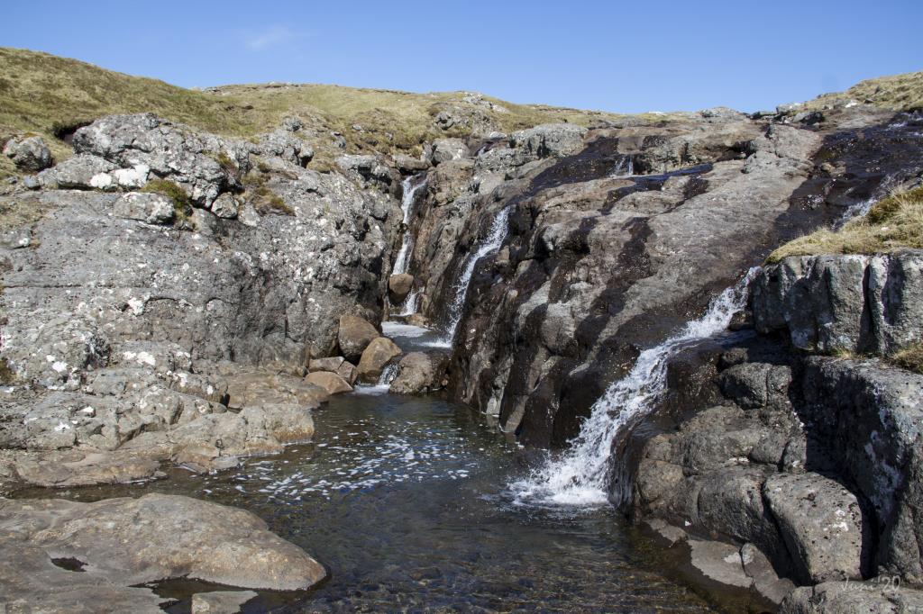 Along the path there are some cosy places where you just enjoy the moment with a cup of coffe. This is when crossing th river of Áin á Fjøllum. Photo: Óli Gardshodn
 -
 The view up on Suðansbrekka at 420m, is breathtaking. This view is in the direction of Slættanes with the mountains north of Vestmanna in the background. Photo: Óli Gardshodn
 -
 The view north to the spectacular mountains north of Vestmanna. In the forground Úti í Haga and Fagridalur. In the background the mountain of Høvdin just vest of Saksun. Photo: Óli Gardshodn
 -
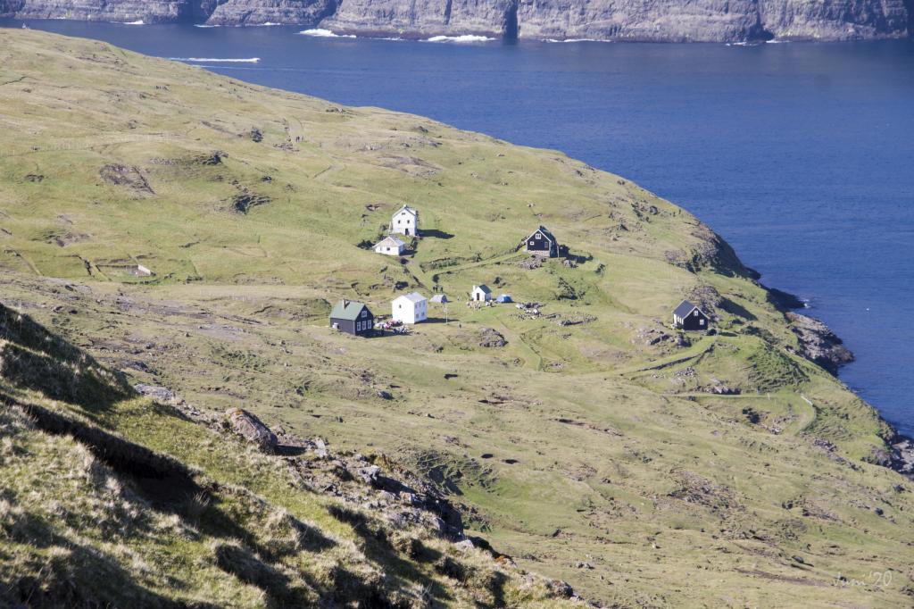 Suddenly the village of Slættanes arrives. Once left but now a tempting place for a remote summerstay. Photo: Óli Gardshodn
 -
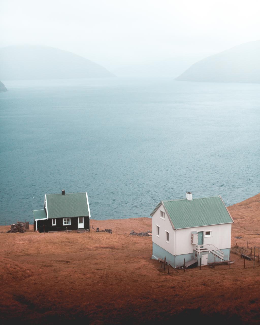 Houses in Slættanes. Photo: Rannvá Joensen
Úr Sørvági, eftir Slættanesgøtuni, gjøgnum víðu og vøkru náttúruna við Fjallavatn, norður til Slættanes
Túrurin byrjar við vatnbrunnarnar í Húsadali í Sørvági. Gingið verður eftir Slættanesgøtuni norður móti Fjallavatni, haðan farið verður um Tunguánna niðan í mjáa Mýrubotnin. Haðan verður gingið norður um fjallaryggin beint norðan fyri Tungufelli og so gjøgnum Slættaneshagan norður til Slættanes.
Tað er møguligt at ganga túrin úr báðum endum. Tað valdast eitt sindur, hvaðan komið verður, tí onki vegasamband er til Slættanes – uttan til gongu ella við báti.


Sørvágur - Slættanes
Public Transport
There is no road to Slættanes.
Bus Route 300 is driving to and from Sørvágur.
Arriving by car
Parking, Sørvágur
You can park your car by the water reservoir that lies by the unpaved road near the river Kirkjuá – note the green lines. From here, follow the blue line for about 600 metres, to the infield gate, where the path starts. The first cairn is just outside the gate.
-
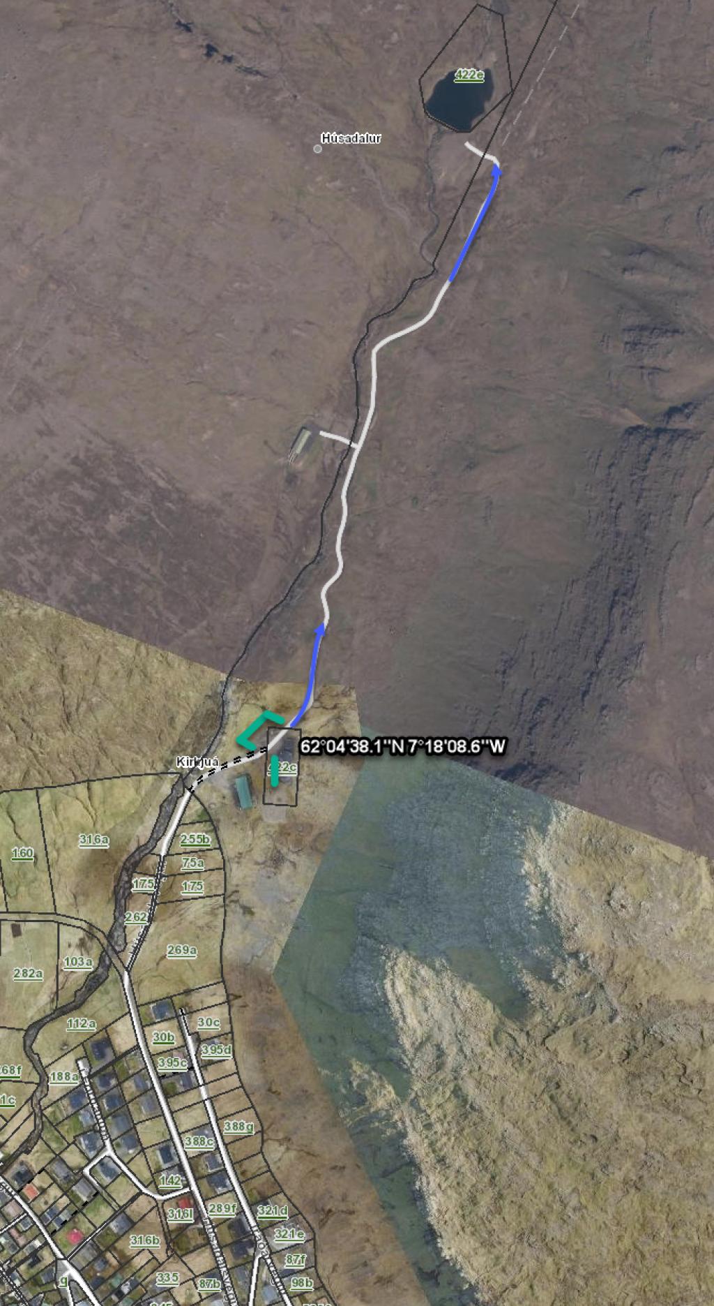 See green line for parking and blue line for starting point
 -
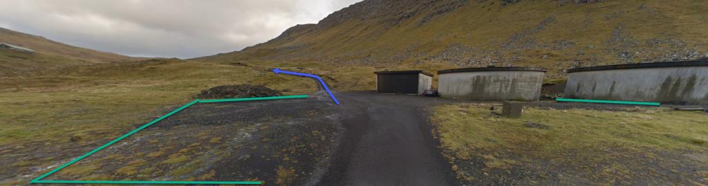 See green line for parking and blue line for starting point
 -
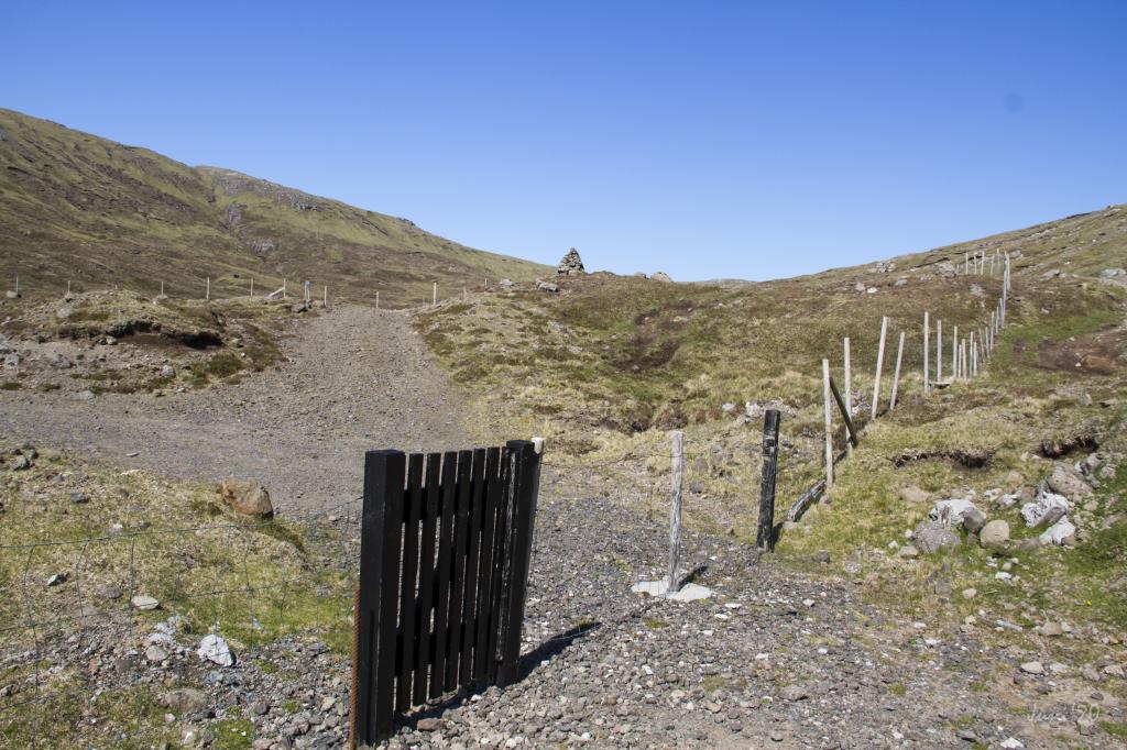 Starting point - gate
 -
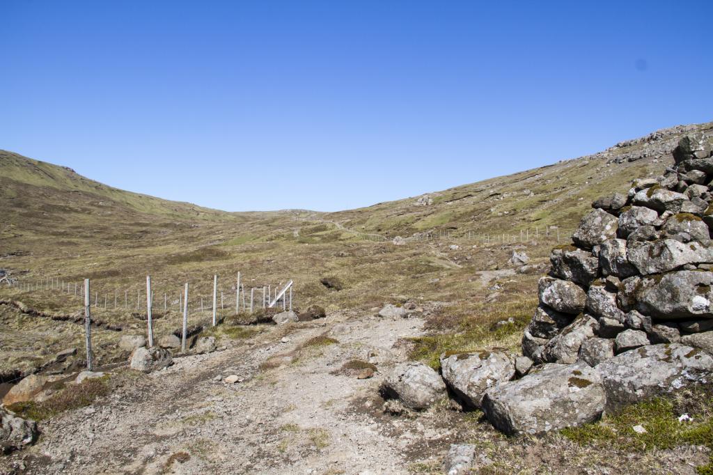 Starting point - first cairn
Slættanes - Sørvágur
There is no road to Slættanes.
Parkering, Slættanes: not possible
-
There is no road to Slættanes.
Sørvágur - Slættanes
Slættanes - Sørvágur
Fakta

Tíð

longd

Hægsta stað

Hæddarmetrar
 Suitable for children over 8 as young children may find the hike long. The hike up from Slættanes is somewhat strenuous
 Medium
-
Medium
-
 Grass-covered and good for walking throughout
